Bridging the Gap Between Detection and Prediction
AI-powered drone intelligence that puts real-time wildfire situational awareness in the hands of first responders — before the first ground crew ever arrives.
Wildfire Intelligence Is Too Slow, Too Limited, and Too Uncertain
Initial-attack decisions must be made within minutes. Yet current drone systems have limited operational reach, existing forecasts may arrive after conditions have changed, and black-box prediction models are difficult for incident commanders to validate and trust.
Drone Coverage Ends Too Soon
Many public-safety drones provide only a few miles of practical operating range and approximately 40 minutes of flight time. These limitations make persistent monitoring difficult across large wildland jurisdictions, remote ignition areas, and expanding fire perimeters.
Forecasts Arrive Too Late
Existing wildfire forecasting workflows may require minutes or hours to collect data, initialize models, and produce results. During initial attack, intelligence that is several minutes old may no longer reflect the fire's current behavior. Commanders need predictions that update as conditions change.
Black-Box Predictions Are Hard to Trust
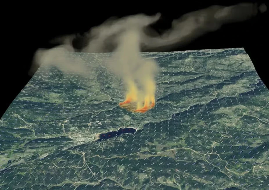
Data-driven models require large amounts of representative fire data, yet every incident involves different terrain, fuels, weather, and suppression activity. Fireflyt uses live observations and physics-based modeling to produce explainable forecasts with measurable uncertainty rather than unsupported black-box outputs.
The Fireflyt Approach
Fireflyt addresses wildfire response through a two-tier intelligence platform — combining AI-driven predictive software with autonomous drone hardware to deliver actionable situational awareness from the earliest moments of ignition. Together, these layers give fire departments a continuous operational picture that starts well before any ground crew can deploy and persists long after a fire is contained.
Wildfire Mapping and Prediction
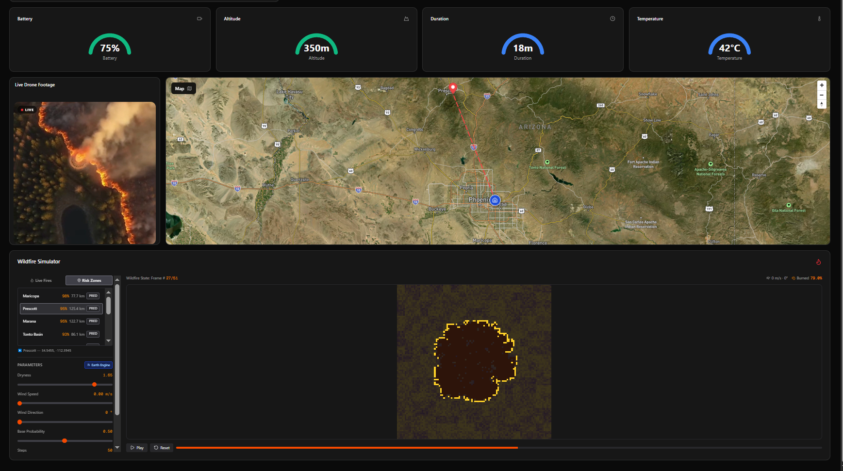
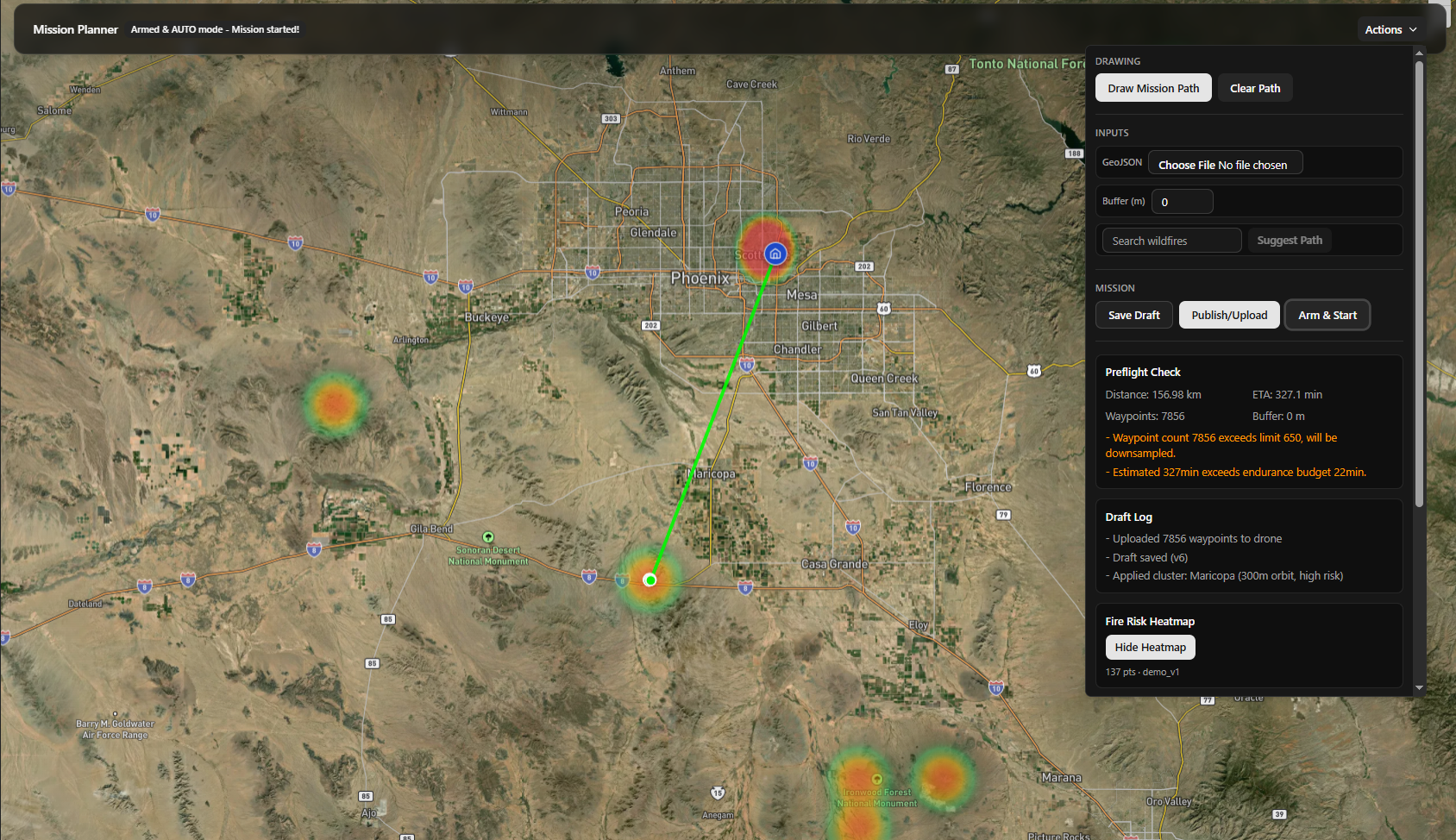
Our software platform gives fire departments and response teams advanced pre-detection and prediction capabilities ahead of any physical deployment. We continuously process live satellite data from NASA FIRMS alongside Google Earth Engine's Alpha Earth Embeddings to assess wildfire ignition risk across proximity zones — surfacing active alerts and risk assessments before a situation escalates.
At the core of the prediction engine, machine learning models trained on historical fire behavior, terrain topology, and real-time environmental conditions generate dynamic spread simulations for fires in your area. These simulations translate directly into tactical intelligence: the estimated closest point of contact with the fire perimeter, windows of minimal spread suitable for safe crew ingress, and a clear operational distinction between actively burning zones and dead, burned-out terrain. As conditions evolve, the platform continuously refines its output — keeping incident command ahead of the fire rather than reacting to it.
- Proximity wildfire risk assessment with live NASA FIRMS alerts
- AI/ML ignition risk modeling using terrain type and environmental data
- Cellular-automata fire spread simulation with configurable wind and dryness parameters
- Tactical analytics: closest point of contact, least-spread windows, active vs. burned zone mapping
Onboard Intelligence and Autonomy
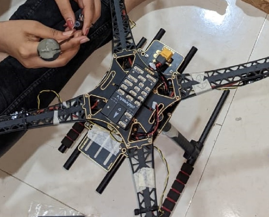
When a wildfire event is identified, Fireflyt dispatches autonomous drones directly to the site — arriving ahead of any ground or manned aerial crews. Each drone is equipped with HD cameras, LiDAR sensors, and thermal imaging, providing continuous multi-spectrum coverage of the fire zone from the moment of first dispatch. There is no manual piloting required; the platform handles navigation, obstacle avoidance, and data relay autonomously from takeoff to landing.
Onboard an NVIDIA Jetson Nano paired with a custom flight controller, each drone performs real-time processing for fully autonomous flight and live data relay. This enables persistent aerial monitoring across the full lifecycle of a wildfire — from initial ignition through active spread and final containment. The intelligence captured becomes a permanent operational record: stored footage of complete fire cycles, high-resolution terrain maps documenting post-fire impact, and analytics that support community recovery and renovation planning for affected areas. Every deployment also feeds back into our models, making future responses faster and more precise.
- Autonomous early dispatch — on-site before any manned crew
- HD cameras, LiDAR, and thermal sensors for multi-spectrum site coverage
- NVIDIA Jetson Nano onboard processing for autonomous flight and real-time predictions
- Full wildfire lifecycle monitoring: ignition, spread, containment, and post-fire terrain mapping
- Structured data for community recovery forecasting and future mission efficiency
Built for Real Incident Airspace
Wildfire airspace is tightly controlled. Fireflyt is being developed with fire-department partners to support coordinated deployment within established incident air-operations procedures, including temporary flight restrictions and single-aircraft operating cycles.
The system is designed around a launch, arrive, collect, recover, and relaunch workflow so it can operate within jurisdictions that permit only one unmanned aircraft in the incident area at a time.
- Operates within approved TFR procedures
- Supports airspace deconfliction with incident air operations
- Designed for authorization-based deployment
- Built around single-aircraft operating cycles
Backed by industry leadership


Funded — ASU EPICS Elite & Venture Devils
Selected to pitch FireFlyt at two of Arizona State University's top entrepreneurship showcases, EPICS Elite and Venture Devils, and secured $3,000+ in funding to support the platform's continued development.
In Collaboration with Scottsdale Fire Department and Police Department
Working directly with Scottsdale Police and Fire Department in Arizona to validate our platform against real-world first-responder operational requirements.
Where we originate